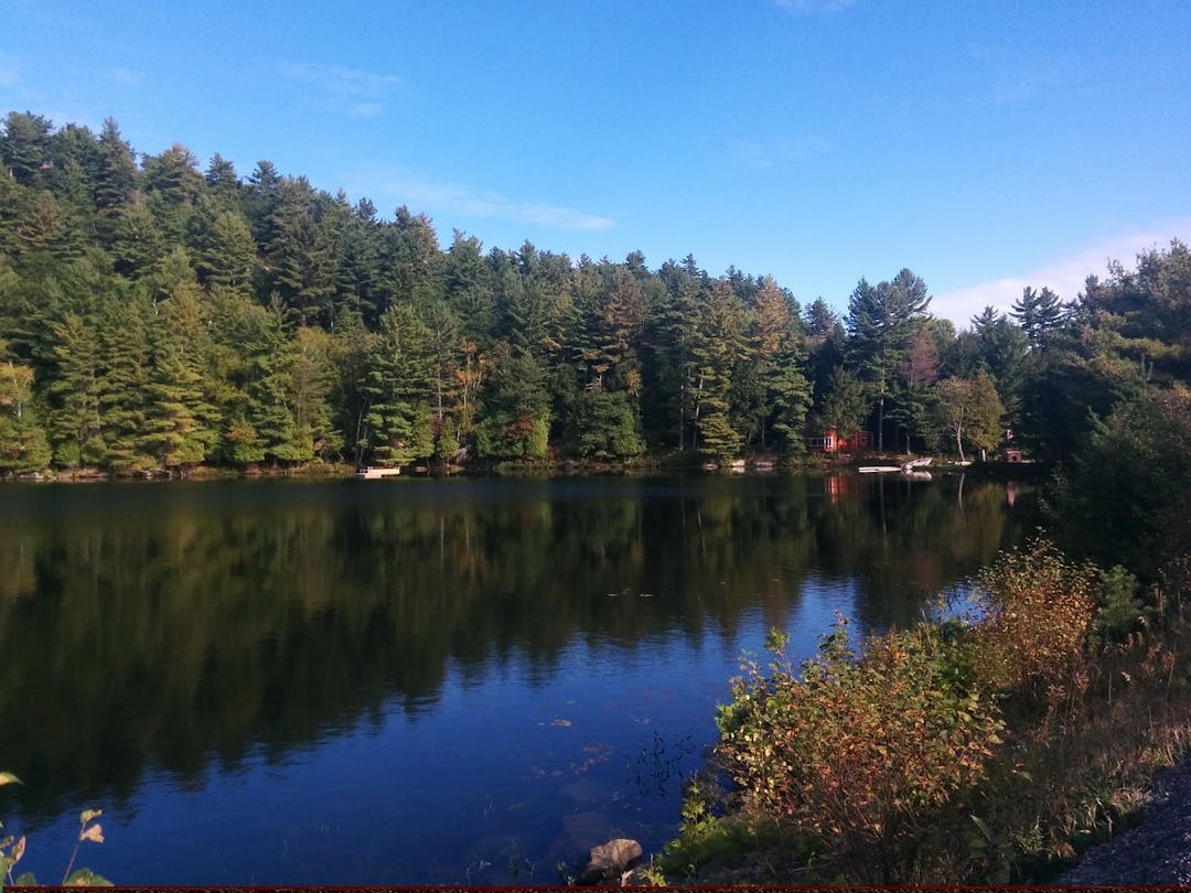
The Vision behind Shoreline Preservation Bylaw 4169
The County of Haliburton is blessed with many lakes that serve important environmental, economic and social roles. Haliburton is unique in that it includes natural lakes and managed water level or reservoir lakes that form part of the Trent Severn Waterway. These lakes support a variety of aquatic species, flora and fauna. They support a vibrant tourism economy and are home to many residents. They provide countless opportunities for recreational activities such as swimming, boating and fishing to name a few. The health of our lakes is important for current and future residents and businesses.
The health of our lakes is determined by a variety of factors, natural and human, things that happen on the land and in the water. As one of many stewards of lake health, the County of Haliburton will continue to do all that it can do to preserve the quality of water in our community.
This Shoreline Preservation By-law applies to lands 20 metres from the high water mark of all lakes, rivers, streams and ponds within the geographical areas of the lower-tier municipalities of Algonquin Highlands, Highlands East and Minden Hills, as well as natural heritage features and areas, like significant wetlands, that play a role in water quality.
This Shoreline Preservation By-law recognizes the rights of shoreline property owners to use and enjoy their property, including minor landscaping, creation of access and views to the water and normal forest and/or tree management. A property owner that is pruning a diseased tree, creating a new perennial bed, replacing an existing pathway, installing a fire pit, undertaking minor repairs to an existing retaining wall, or similar activities, will not have to apply for a permit under this By-law.
Instead, this Shoreline Preservation By-law is intended to apply to situations where a property owner (or someone acting on behalf of the property owner) intends to significantly alter the grade or topography of a property in a manner that increases the flow of surface water to neighbouring lands or bodies of water. It is also intended to apply to situations when significant removal of trees and/or vegetation is proposed.
In such instances, property owners (or someone acting on behalf of the property owner) will be required to apply for and receive permit approval before such significant projects and activities are undertaken in the shoreline buffer area. The By-law includes a transition model for implementation and a regular review and update period.
This By-law is flexible. While the By-law includes a uniform shoreline buffer, it is recognized that there are varied shoreline lot characteristics in the geographical areas of the lower-tier municipalities of Algonquin Highlands, Highlands East and Minden Hills. This By-law recognizes these varied characteristics and allows for lesser buffers, where appropriate. This By-law is also intended to be applied on a “go forward” basis and does not affect existing development or landscaping. The By-law also establishes opportunities for property owners to speak to County Council (or delegate) directly should a decision on a permit not be made in a timely manner or if they would like to dispute a decision or condition of decision.
The Purpose of Shoreline Preservation Bylaw 4169
The Council for the County of Haliburton deems it desirable and in the public interest to enact a by-law to protect shoreline areas for the purposes of achieving:
- the objectives of the Official Plan for the County of Haliburton;
- managing the further loss of natural shorelines within the County of Haliburton;
- a greater proportion of native vegetative contiguous cover;
- a minimum 75 percent native vegetative cover overall;
- a minimum 50 percent high quality native vegetative cover;
- a naturalized riparian areas on lakes and along rivers/streams;
- an increased ecological health based on the status of indicator species and maintenance of natural biodiversity;
- decreased destruction or injuring of trees, native vegetation, habitat and natural areas;
- reduction of negative impacts on the environment;
- contributing to human health and quality of life;
- maintaining water quality;
- maintaining and enhancing natural habitat;
- preventing soil erosion and water run-off;
- preventing topographical changes to the shoreline areas; and
- protecting fish habitat as defined in the Fisheries Act, Revised Statute of Canada 1985;
The When, What and Where of Shoreline Preservation Bylaw 4169
When - On April 1st, 2023, Shoreline Preservation By-law 4169 came into effect.
What - It applies to the shoreline and prohibited areas.
Where - It applies to the geographical areas of the lower-tier municipalities of Algonquin Highlands, Highlands East and Minden Hills.
Shoreline is the area of land measured over a horizontal distance that is located within 20 metres from the high water mark of a body of water.
Prohibited areas are:
- Provincially significant wetlands,
- Environmental Protection or Hazard Lands as identified in the County or Lower-tier municipality Official Plan including wetlands, but excluding terrestrial features or areas such as deer wintering areas,
- Lands owned by the County, lower-tier municipality or the province including a road allowance.